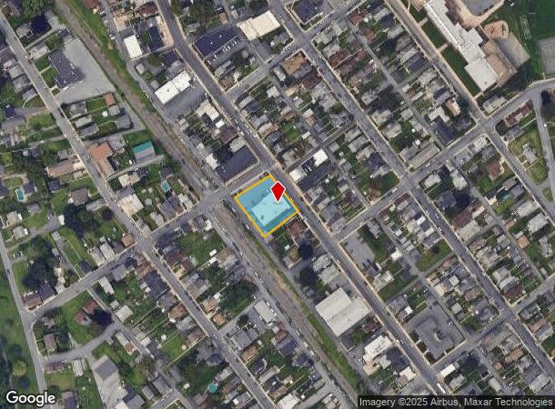
Property Record
1620 Main St, Northampton, PA 18067


Current Lease Availabilities
NEARBY LISTINGS FOR SALE OR LEASE
Property Detail
1620 Main St
Storebuilding
Northampton
X
Pennsylvania
42095C0236E
0.49 AC
2025
Lehigh Valley
2025
Philadelphia
016201
Allentown-Bethlehem-Easton, PA-NJ
7,116 SF
L4SW4C-9-1-0522
DEMOGRAPHICS near 1620 Main St
1 Mile
3 Mile
5 Mile
2024 Total Population
10,376
41,337
88,816
2029 Population
10,446
41,538
89,421
Pop Growth 2024-2029
+ 0.67%
+ 0.49%
+ 0.68%
Average Age
41
42
41
2024 Total Households
4,322
16,823
35,047
HH Growth 2024-2029
+ 0.69%
+ 0.49%
+ 0.67%
Median Household Inc
$69,033
$73,078
$71,205
Avg Household Size
2.40
2.40
2.50
2024 Avg HH Vehicles
2.00
2.00
2.00
Median Home Value
$196,297
$224,593
$236,426
Median Year Built
1948
1963
1968
Nearby Places
- Restaurants
- Banks
- Shops
- Fitness
- Groceries
PUBLIC TRANSPORTATION
AIRPORT
Lehigh Valley International
DRIVE
WALK
Distance
Lehigh Valley International
14 min
6.0 mi
Freight Ports
Port of Philadelphia
DRIVE
WALK
Distance
Port of Philadelphia
92 min
67.9 mi
Nearby Properties
Address
Land Use
TOTAL SIZE
Lot Size
Zoning
Address
Land Use
TOTAL SIZE
Lot Size
Zoning
230,853 SF
96.66 AC
R-3
Address
Land Use
TOTAL SIZE
Lot Size
Zoning
453,600 SF
32.57 AC
PIO
Address
Land Use
TOTAL SIZE
Lot Size
Zoning
175,714 SF
46.35 AC
R-3
Address
Land Use
TOTAL SIZE
Lot Size
Zoning
1,046,625 SF
69.55 AC
RS
Address
Land Use
TOTAL SIZE
Lot Size
Zoning
956,444 SF
I
Address
Land Use
TOTAL SIZE
Lot Size
Zoning
504,475 SF
39.36 AC
I
Address
Land Use
TOTAL SIZE
Lot Size
Zoning
85.20 AC
I2
Address
Land Use
TOTAL SIZE
Lot Size
Zoning
260,803 SF
36.23 AC
C-2
Address
Land Use
TOTAL SIZE
Lot Size
Zoning
1,050,392 SF
218.15 AC
RS
Address
Land Use
TOTAL SIZE
Lot Size
Zoning
605,893 SF
I
Address
Land Use
TOTAL SIZE
Lot Size
Zoning
60,052 SF
23.96 AC
C-2
Address
Land Use
TOTAL SIZE
Lot Size
Zoning
50,343 SF
10 AC
R-3A
Address
Land Use
TOTAL SIZE
Lot Size
Zoning
45,176 SF
11.04 AC
R-4
Address
Land Use
TOTAL SIZE
Lot Size
Zoning
95,776 SF
23.70 AC
INS
Address
Land Use
TOTAL SIZE
Lot Size
Zoning
185,794 SF
30.91 AC
C-2
Address
Land Use
TOTAL SIZE
Lot Size
Zoning
96,999 SF
19.37 AC
INS
Address
Land Use
TOTAL SIZE
Lot Size
Zoning
105,219 SF
47.10 AC
RA
Address
Land Use
TOTAL SIZE
Lot Size
Zoning
164,816 SF
48.85 AC
R1
Address
Land Use
TOTAL SIZE
Lot Size
Zoning
292,700 SF
21.68 AC
RS
Address
Land Use
TOTAL SIZE
Lot Size
Zoning
316,786 SF
29.22 AC
I2
Address
Land Use
TOTAL SIZE
Lot Size
Zoning
137,317 SF
14.25 AC
C-2
Address
Land Use
TOTAL SIZE
Lot Size
Zoning
262,476 SF
30.77 AC
I2
Address
Land Use
TOTAL SIZE
Lot Size
Zoning
111,371 SF
9.71 AC
C-2
Address
Land Use
TOTAL SIZE
Lot Size
Zoning
107,414 SF
4.20 AC
I
Address
Land Use
TOTAL SIZE
Lot Size
Zoning
15,624 SF
6.09 AC
R3
Address
Land Use
TOTAL SIZE
Lot Size
Zoning
65,524 SF
22.48 AC
I
Address
Land Use
TOTAL SIZE
Lot Size
Zoning
3,522 SF
20.74 AC
R3
Address
Land Use
TOTAL SIZE
Lot Size
Zoning
55,048 SF
12.47 AC
C-2A
Address
Land Use
TOTAL SIZE
Lot Size
Zoning
11,040 SF
4.18 AC
C-1
Address
Land Use
TOTAL SIZE
Lot Size
Zoning
301,097 SF
14.19 AC
I
The World's #1 Commercial Real Estate Marketplace
Connect with us
© 2025 CoStar Group
The information above has been obtained from sources believed reliable. While we do not doubt its accuracy we have not verified it and make no guarantee, warranty or representation about it. It is your responsibility to independently confirm its accuracy and completeness. Any projections, opinions, assumptions, or estimates used are for example only and do not represent the current or future performance of the property. The value of this transaction to you depends on tax and other factors which should be evaluated by your tax, financial, and legal advisors. You and your advisors should conduct a careful, independent investigation of the property to determine to your satisfaction the suitability of the property for your needs.